- March 18, 2016
- Posted by: BlueSkies
- Categories: Extreme Weather, Forensic Meteorology, Hazard Mitigation
Chaos
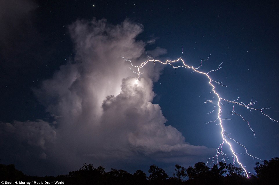
A bolt from the blue. A rogue wave.
As anyone who has lived on planet Earth for more than a few seasons can attest, nature is full of surprises.
Lightning usually strikes near the core of a thunderstorm, but occasionally it will strike more than 20 miles away, arcing across an otherwise peaceful sky. Ocean swells on a placid sea tend to be of a similar height, but rarely, a rogue wave many times the average height can appear suddenly, damaging or devouring any ship unlucky enough to be in its path.
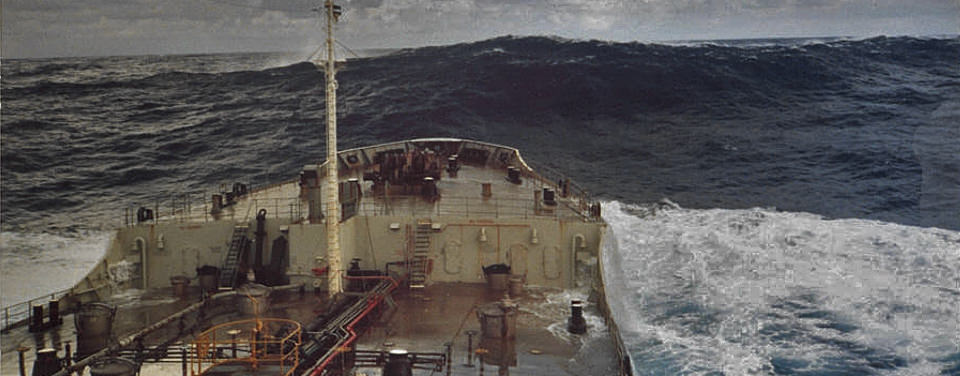
Bolts from the blue and freak waves are just two examples of variability and chaos in nature. Here chaos describes a sensitive dependence on initial conditions – the proverbial butterfly flapping its wings in Africa that leads to a hurricane over the Bahamas. If the surface temperature had been just slightly cooler, that bolt from the blue would have sliced the air directly under the storm. If winds over the ocean had been just a tad bit different, that rogue wave would never have formed.
Variability
It is due to this chaos that atmospheric scientists so often speak in terms of probabilities and distributions (as frustrating as that can be to folks who just want to know whether a rain shower will or will not do the work of watering their lawn this weekend – I promise if we knew, we’d tell you).
The chaotic nature of the weather leads to variability both between events and within a single event. Thunderstorms are a perfect example: no two thunderstorms are alike, and each storm changes from moment to moment.
To describe such variability, we typically speak of averages and deviations from that average. For thunderstorms, we can describe the average peak thunderstorm wind for an area – say 40 mph for summer afternoon thunderstorms in north-central Florida. However, peak winds in exceptionally strong thunderstorms have been recorded at over 70 mph in this region, while winds in weaker storms may not exceed 25 mph. And within a storm that produces a 70 mph gust, winds are not sustained at that speed throughout the event. The sustained wind speed within such a storm averaged over a 2-minute period may only be 45 mph.
Building codes typically ensure that structures and infrastructure are built to withstand expected conditions for a given area – roofs in snowy areas must be able to withstand a higher load than in areas without snow; structures in hurricane-prone regions must be able to withstand higher winds; structures in seismically active areas must be able to withstand earthquakes. It’s generally not average conditions that cause damage – it’s the exceptions, those events that vary greatly from what is normal and expected.

In the case of thunderstorm wind damage, it’s the gusts. How gusty winds are during a given event depends on a number of factors, but mostly on the surrounding terrain: the rougher the terrain, the gustier the winds. Winds are far gustier in the center of a city, surrounded by skyscrapers and densely packed buildings of many sizes than in a smooth, open farm field.
To illustrate, given a weather station measurement of the 1-minute average wind speed, we would expect peak 3-second wind gusts in the heart of a major city to be nearly 250% higher than that average speed, while peak wind gusts over open farmland would be less than 50% higher.
The orientation of landscape features to the wind direction also impacts wind speed and gustiness. For coastal areas, this is particularly noticeable. Onshore winds – those that have blown unimpeded over a lake or ocean – tend to be stronger and steadier, all else being equal, than winds that have blown over a rough landscape (say, across a large metropolitan area). Similarly, winds blowing parallel to city streets tend to be felt more strongly than those blowing perpendicular.
Reconstructing Damaging Conditions – It’s More Than Just Reading the Station Data
When evaluating weather station data to determine the peak wind speed associated with a given event, we must consider the location of the weather station. Is it a rural site or an urban site? What is the terrain like surrounding the station? Are there certain directions from which the wind would be more impeded or would be blowing over rougher terrain?
How does the weather station site compare to the site at which damage was reported? Is the surrounding terrain similar? Was damage reported at an elevated location – for example, the roof of a high-rise building, where winds tend to be stronger? Differences in both roughness and height must be considered.
Also of obvious importance in the evaluation of winds associated with tropical cyclones and thunderstorms is estimation of the relative strength of the system when it impacted the weather station versus the damage site. If the damage site was directly impacted by the core of a severe thunderstorm while the nearest weather station experienced only a glancing blow, we would expect the winds experienced at the damage site to be stronger than those recorded at the weather station.
Evaluation of these considerations – location, orientation, height, and roughness – allows forensic meteorologists to estimate peak wind speeds from measured average wind speeds and to evaluate the extent to which a given weather station is an accurate proxy for the site at which damage was reported. The weather station data is just the beginning.
“The devil is in the details.” Nowhere is this truer than in the beautifully chaotic weather, where details determine outcomes.
If you or a client experienced wind damage and need an estimate of the wind speed associated with that weather event, call or email Blue Skies Meteorological Services for a free consultation.